A new, comprehensive data set on the displacement of the Earth's crust in Antarctica was published in the journal Earth System Science Data on 6 May 2025. In cooperation between research groups from Germany, Australia, USA and the United Kingdom data from geodetic GNSS (Global Navigation Satellite Systems) stations in Antarctica were reprocessed to infer precise and precise coordinate time series.
For the first time measurements from almost all available stations were analysed, which are distributed across the entire Antarctic over a period from 1995 to 2021. To this end, Mirko Scheinert of TUD Dresden University of Technology (Germany) together with Matt King from the University of Tasmania in Hobart (Australia), initiated the Geodynamics In ANTarctica based on REprocessing GNSS dAta INitiative (GIANT-REGAIN), supported by the Scientific Committee on Antarctic Research (SCAR) and its Geodetic Infrastructure in Antarctica expert group (EG GIANT) as well as SCAR INSTANT SC2.2 Probing the Solid Earth and Its Interaction. The success of the project was only possible because of this excellent international cooperation within SCAR, which made the measurement data available from the many different national Antarctic programmes.
Four analysis centres – TUD Dresden University of Technology (Germany), University of Tasmania (Australia), Ohio State University (USA) and Newcastle University (UK) – first analysed the data independently of each other using different software, but according to uniform rules, before a joint, combined solution was derived. The most important product of the study are time series of point coordinates with north, east and vertical components for 286 stations, which can be freely downloaded from PANGAEA, the repository for georeferenced earth system research data hosted in Germany.
These coordinate time series form an invaluable basis for further research into the geodynamics of Antarctica, in particular regarding the displacement of the Earth's crust in response to changing ice loads. The separation between the effects of present-day and past ice mass changes is a highly topical research question. There are international research and ongoing discussions on how the glacial-isostatic adjustment can be described in much more detail to better understand how the solid Earth reacts to ice mass changes that have been occurred throughout glacial history since the last glacial maximum. Findings from this research form a central link in the assessment of past, present-day and future Antarctic ice mass balance and sea level change.
Buchta, E., Scheinert, M., King, M. A., Wilson, T., Koulali, A., Clarke, P. J., Gómez, D., Kendrick, E., Knöfel, C., and Busch, P.:
Advancing geodynamic research in Antarctica: reprocessing GNSS data to infer consistent coordinate time series (GIANT-REGAIN),
Earth Syst. Sci. Data, 17, 1761–1780, https://doi.org/10.5194/essd-17-1761-2025, 2025.
Contact:
Mirko Scheinert
TUD Dresden University of Technology | Chair of Geodetic Earth System Research
01062 Dresden, Germany | Email:
Figures:
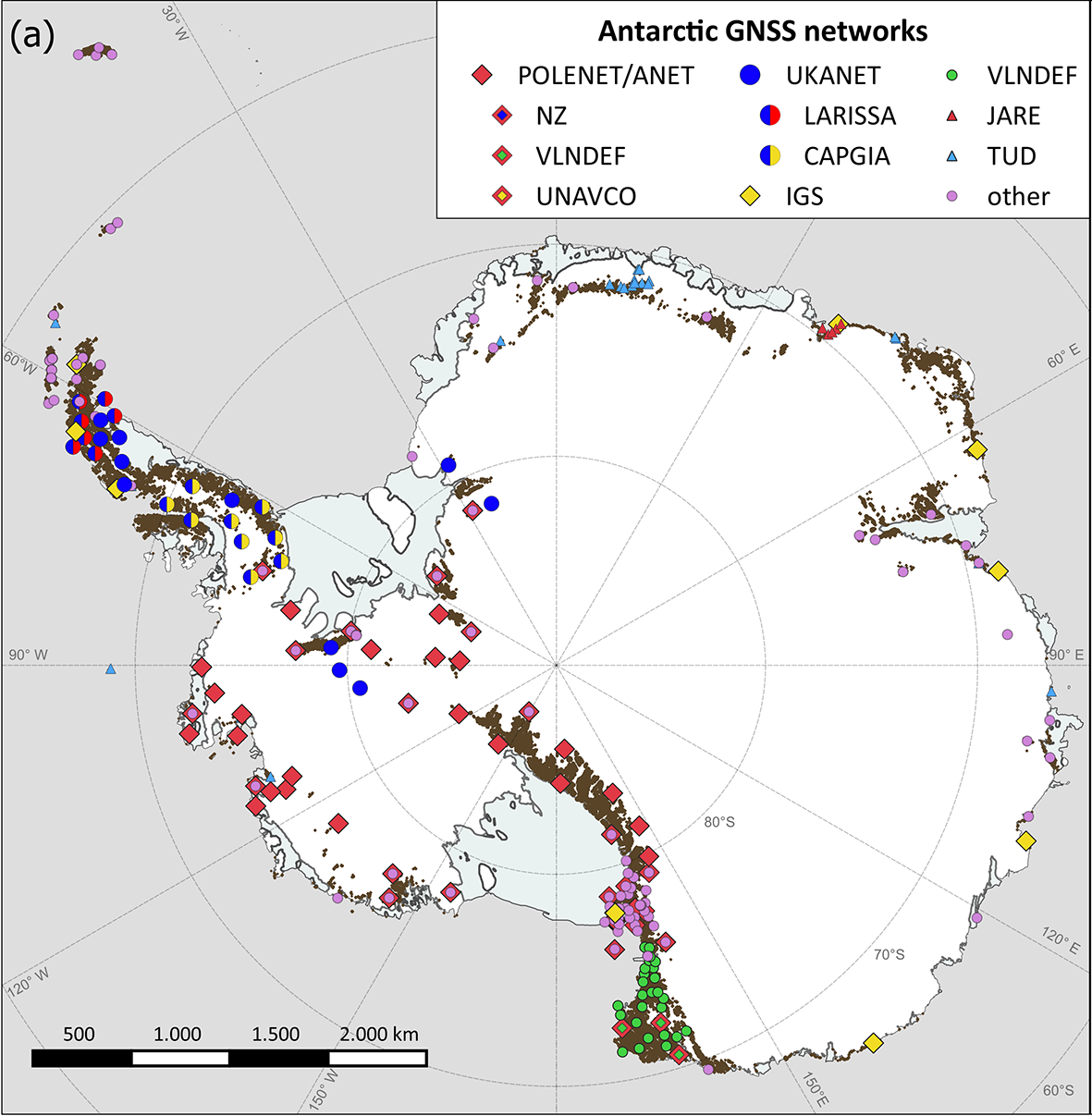
Distribution of the GNSS sites in Antarctica (from Buchta et al. 2025, Fig. 1).
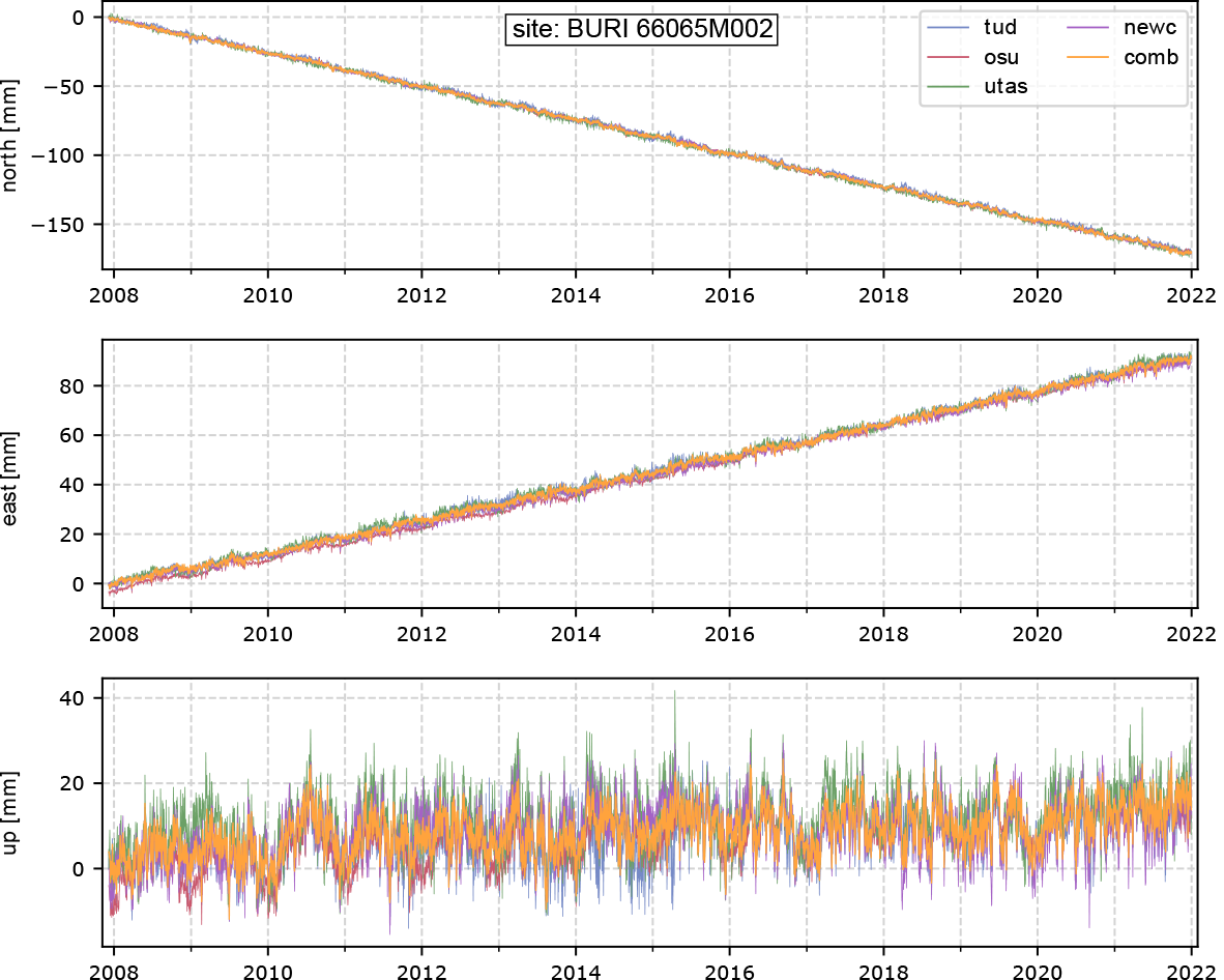
Coordinate time series of the site Butcher Ridge (Transantarctic Mts.), from top to bottom: north, east and vertical (up) components (from Buchta et al. 2025, Fig. 5).
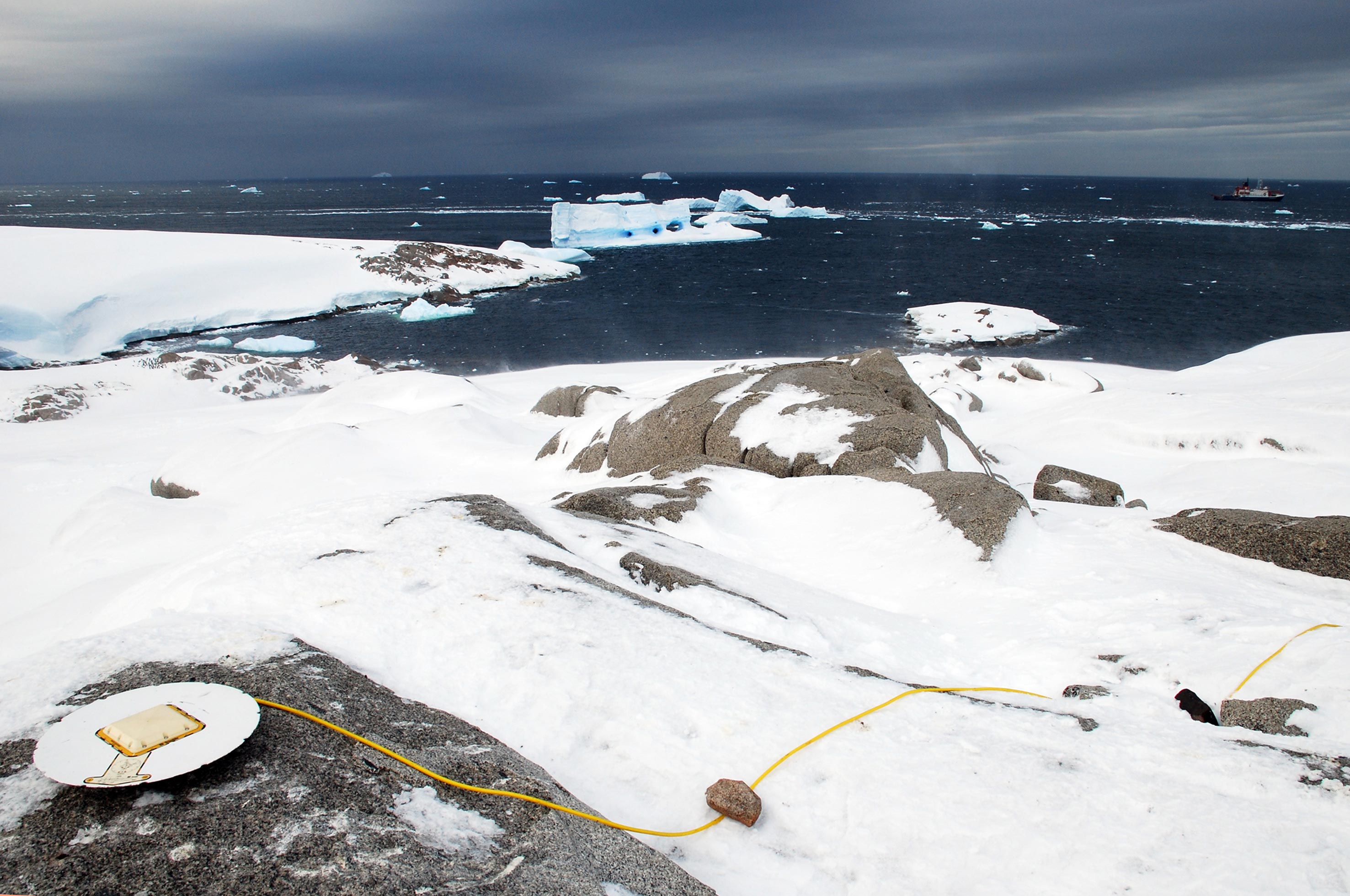
GNSS campaign site in Pine Island Bay, West Antarctica. Photo © Mirko Scheinert.
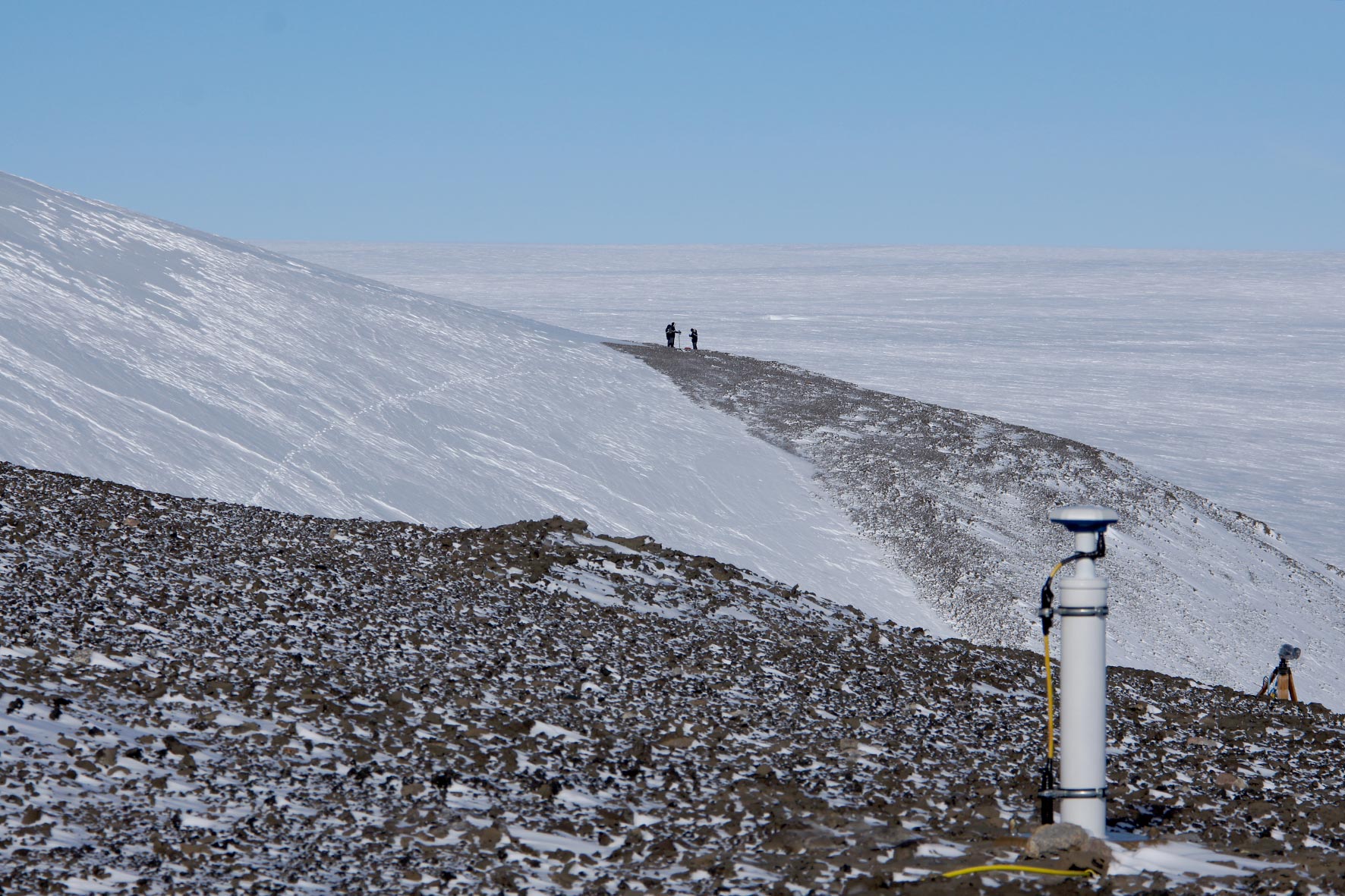
GNSS permanent station at Gaussberg, East Antarctica. Photo © Mirko Scheinert.